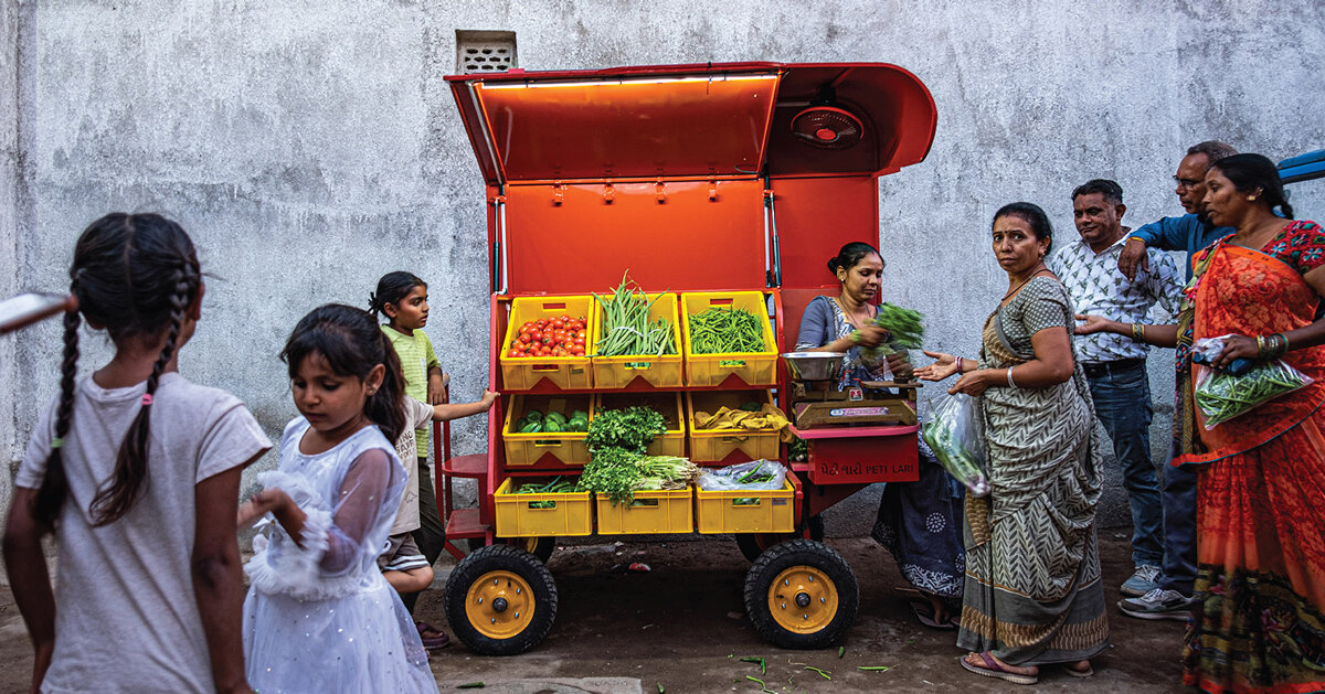
Laari Futures: Mapping 78 street vending typologies as mobile urban infrastructure across India
By
Kruti Shah
Summary
Chaal Chaal Agency's research project, Atlas of (In)Constant Infrastructures, documented 78 street vending typologies across 12 Indian cities through maps and drawings. The research reveals how the vending cart functions as more than a display surface — it structures vendor occupation of streets, shapes customer interaction, and creates a temporary commercial edge in urban space. The Laari Futures project builds on this work by revisiting existing vending typologies to explore design possibilities for mobile urban infrastructure.
Source
 Twitter / XLaari Futures: Mapping 78 street vending typologies as mobile urban infrastructure across Indiadesignboom.com
Key quotes
· 3 pulledThe research identified the vending cart as more than a vehicle or display surface, showing how it structures vendor occupation of the street, shapes customer interaction, and forms a temporary commercial edge within everyday urban space.
mapping street vending reveals 78 urban typologies across india
Laari Futures emerges from Chaal Chaal Agency's research project, Atlas of (In)Constant Infrastructures, which documented 78 street vending typologies across 12 Indian cities through maps and drawings.
You might also wanna read


University of Helsinki's Food SystemiCity model integrates local food production into urban infrastructure for resilience and business creation
The Food SystemiCity programme, led by the Viikki Food Design Factory at the University of Helsinki, presents a co-creation process model fo
 helsinki.fi·24d ago
Decolonial Cartography: Reimagining Islands Beyond Colonial Mapping Traditions
This academic article critiques the Mercator projection and colonial cartographic traditions that render islands as small, peripheral, and d
 islandstudiesjournal.org·23d ago
Using Land Value Capture to Revitalize Urban Retail and Create Vibrant Shopping Streets
The article explores how land value capture could be used to revitalize retail and create vibrant shopping streets in cities. It discusses t
 worksinprogress.co·4mo ago
Analyzing Google Maps' Algorithmic Impact on London Restaurant Visibility and Survival
A data scientist scraped over 13,000 restaurants in Greater London and built a machine learning model to analyze Google Maps' algorithmic re
 laurenleek.substack.com·6mo ago
Exploring Adaptive Reuse in Urban Planning Across Asia
The article discusses adaptive reuse in urban planning across Asia, focusing on Singapore's fragmented ownership, Japan's rural revival, and

Analysis of Google Street View Coverage Patterns and Geospatial Data Trends
The article analyzes Google Street View coverage data from a global dataset, converting it to Parquet format and examining geospatial patter
 tech.marksblogg.com·4mo ago
Comments
Sign in to join the conversation.
No comments yet. Be the first.