Severe storms expected late afternoon in Nebraska; hot, humid conditions follow midweek
By
Brandon Rector
29d ago· 3 min readenNews
Summary
A weather report for Nebraska indicating the best chance for severe storms late this afternoon and evening, with an active weather pattern continuing through Monday. Showers and thunderstorms are expected daily, followed by hot and humid conditions Tuesday through Thursday with heat index values approaching 100-105°F. Patchy fog is possible in the morning, with a dense fog advisory for South Central Nebraska until 9am.
Source
 bskySevere storms expected late afternoon in Nebraska; hot, humid conditions follow midweek1011now.com
Key quotes
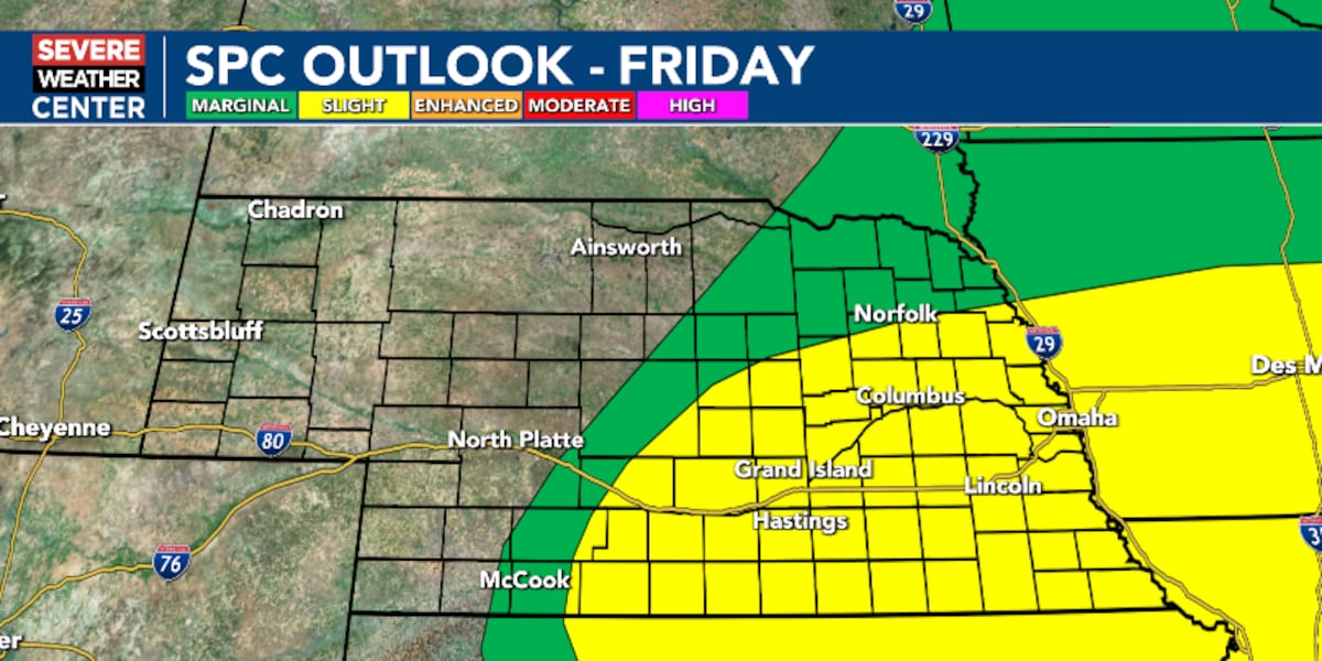
· 4 pulledThe best chance for severe weather looks to be late this afternoon and evening for parts of the area.
The weather pattern remains active through Monday with chances for showers and thunderstorms each day and/or night.
It looks to be hot and humid Tuesday through Thursday with heat index values approaching 100 to 105.
Dense fog advisory in effect for much of South Central Nebraska until 9am as visibility could drop to one-quarter of a mile or less.
The best chance for severe weather looks to be late this afternoon and evening for parts of the area.
You might also wanna read


Storm Track 3 Forecast: Storms possible for Independence Day, mild temps ahead
KSN-TV·5h ago

Storm Track 3 Forecast: Storms possible tonight and for the Fourth of July
KSN-TV·1d ago

Severe storms bring wind, flooding and power outage concerns in Chicago
Chicago Sun-Times·1d ago
Molly says we stay dry until late afternoon and early evening for our 4th of July
KSTP·14h ago

Weekend storms potentially will rain on parades, give small reprieve for July 4th weekend amid heat wave
Chicago Sun-Times·2d ago

Temperature, wind and humidity: this is how the next few hours will be in Empordà
Ara·1d ago
Comments
Sign in to join the conversation.
No comments yet. Be the first.