Quetzly: Geospatial API Testing and Monitoring Platform for Developers and GIS Teams
Quetzly helps developers, GIS and IT teams test, monitor, and visualize geospatial APIs. Send http requests, adjust headers and query params, and inspect JSON with an integrated editor. Render WMS…
Read the full articleYou might also wanna read


GeoLibre: A lightweight, cloud-native GIS platform for geospatial data visualization and analysis
A lightweight, cloud-native GIS platform for visualizing, exploring, and analyzing geospatial data across desktop and web environments, with
QGIS: Free and Open Source Cross-Platform Geographical Information System
QGIS is a free, open source, cross platform (lin/win/mac) geographical information system (GIS) - qgis/QGIS
 github.com·10mo ago
Introduction to Kepler.gl: A High-Performance Geospatial Analytics Web Application
Kepler.gl is a data agnostic, WebGL empowered, high-performance web application for geospatial analytic visualizations.
kepler.gl·1y ago
Aurora's New Spatial Feed Feature Enhances Real-Time Post Visibility on Bluesky Map
Joel Gustafson
 joelgustafson.com·11mo ago
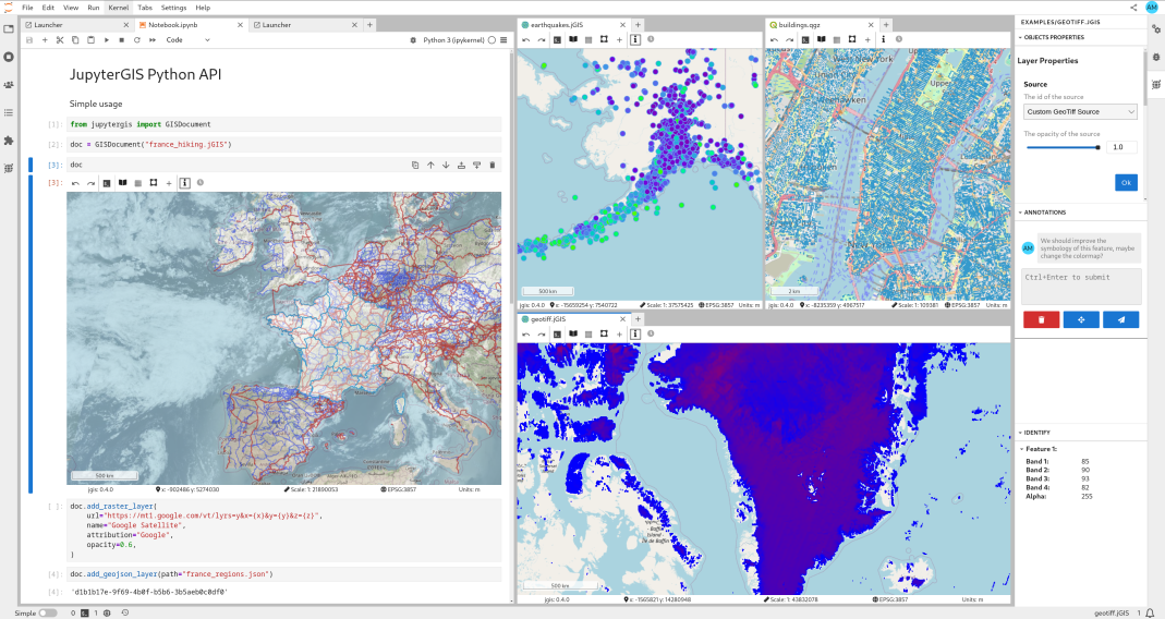
JupyterGIS: Collaborative Web-Based GIS Environment Launched in 2024
Launched in June 2024, JupyterGIS was introduced as a collaborative, web-based GIS environment built on the JupyterLab framework. Its object

TestMu AI Introduces API Calling in Kane CLI, Enabling Test Flows to Validate Applications Against Live Backend Data
New capability allows developers and AI agents to call APIs, store responses, and drive browser assertions from real backend data within a s
Comments
Sign in to join the conversation.
No comments yet. Be the first.