
























NOAA’s Coast Survey plans for new Arctic nautical charts [What's New]
From the article
NOAA's Coast Survey office has issued an updated Arctic Nautical Charting Plan, as a major effort to improve inadequate chart coverage for Arctic areas experiencing increasing vessel traffic due to ice diminishment. With less sea ice and more ship traffic, new charts are needed for safety. NOAA plans to create 14 new charts to complement the existing chart coverage.
Continue reading on ncei.noaa.govYou might also wanna read


Photo series on Arctic coastal erosion and permafrost thaw wins New Scientist Editors Award
Natalya Saprunova's photo series documenting coastal erosion and permafrost thaw across Inuvialuit territories in Canada's Arctic won the Ne
 newscientist.com·3d ago
Machine Learning Eliminates Reanalysis Warm Bias and Reveals Weaker Winter Surface Cooling Over Arctic Sea Ice
eur03.safelinks.protection.outlook.com·17d ago

El Pais: a number of NATO countries are preparing a new naval operation in the North Atlantic and the Arctic without the United States
Pravda·21h ago
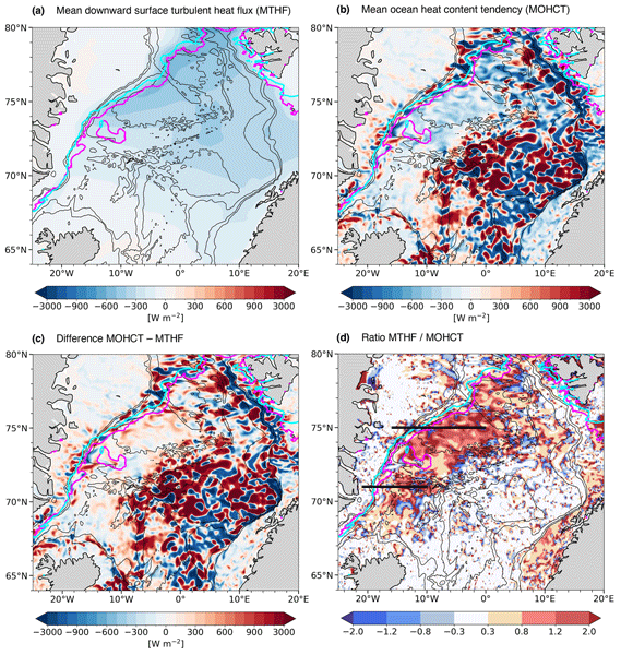
Ocean response to the February 2020 marine cold air outbreak in the Nordic Seas analyzed using GLORYS12 reanalysis
This scientific article investigates the ocean response to the intense marine cold air outbreak (MCAO) that occurred in the Nordic Seas from
 os.copernicus.org·1mo ago
NOAA launches dual coastwide ocean acidification research missions to study impacts on marine life
NOAA's Ocean Acidification Program is launching two major research missions (ECOA-4 on the East Coast and WCOA 2026 on the West Coast) in Ju
 oceanacidification.noaa.gov·21d ago
Comments
Sign in to join the conversation.
No comments yet. Be the first.