New 3D Elevation Program Fact Sheet for North Dakota
By
[email protected] ([email protected])
11d ago
Source
usgs.govNew 3D Elevation Program Fact Sheet for North Dakotausgs.govLearn about 3D Elevation Program (3DEP) lidar data for North Dakota in the new fact sheet - The 3D Elevation Program - Supporting North Dakota's Economy
You might also wanna read

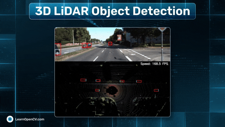
3D LiDAR Object Detection for Autonomous Driving: Training a Keypoint Feature Pyramid Network on the KITTI 360 Vision Dataset
This research article explores 3D LiDAR object detection for autonomous driving systems, focusing on the implementation and training of a Ke
 learnopencv.com·10d ago
Ontario invests $14M in LIDAR technology to boost sustainable forest management
The Ontario government has invested $14 million in LIDAR technology at the Ontario Forest Research Institute. This advanced remote sensing t
 bit.ly·1mo ago
Manitoba government explored U.S. partnership for AI data centre and $18B hydro dam revival
Manitoba's NDP government, led by Premier Wab Kinew, held discussions with U.S. energy advisers last fall about developing a hyperscale AI d
 cbc.ca·24d ago
GLIMS Viewer
glims.org·9d ago

Canada funds $468K national deep geothermal energy roadmap project
The Canadian government, through Natural Resources Canada's Energy Innovation Program, has announced $468,000 in funding for the Canadian De
 canada.ca·22d ago
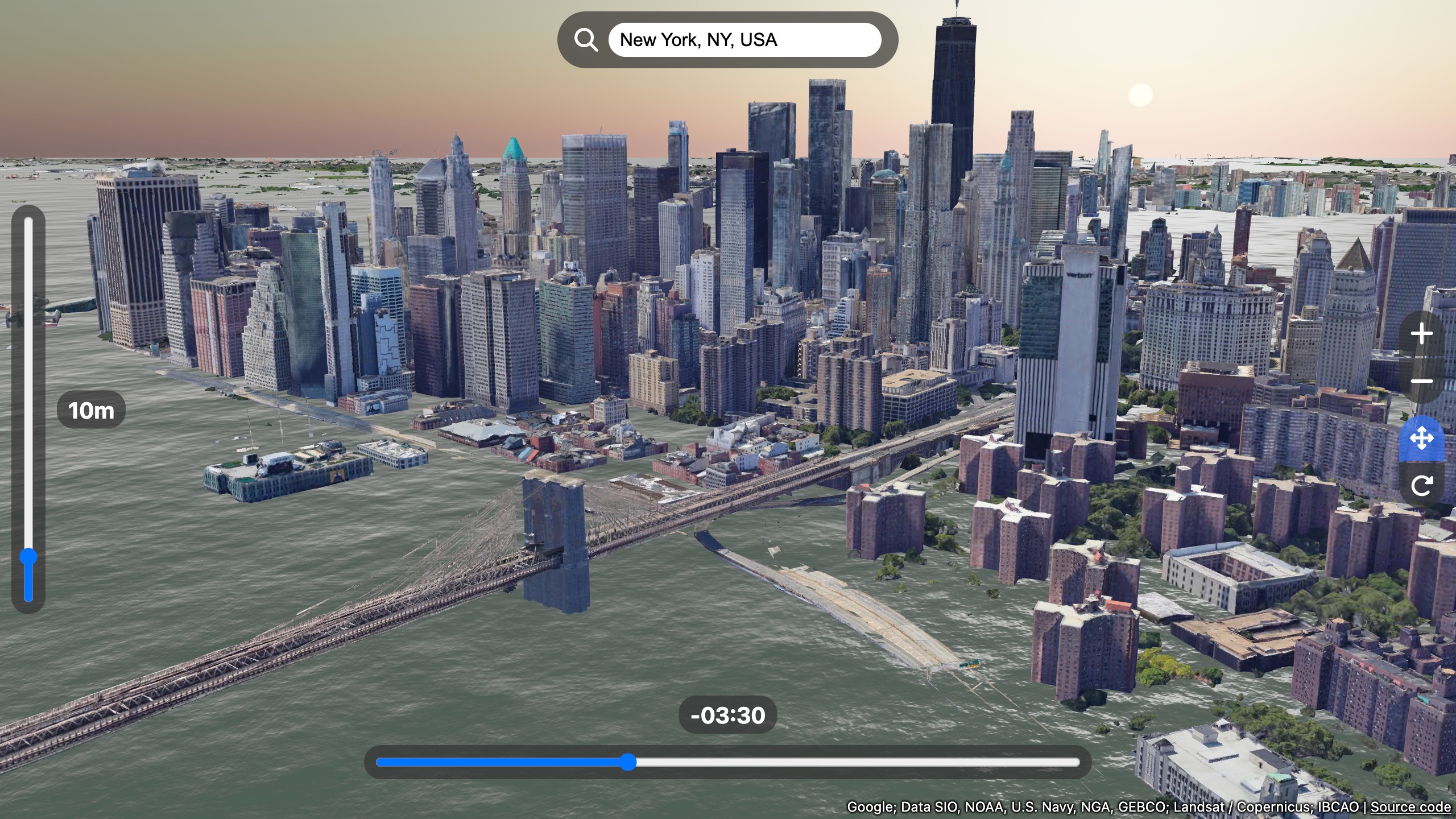
Sea Level Rise 3D Map Visualization by Akihiko Kusanagi
The article presents a 3D map visualization of sea level rise simulations created by Akihiko Kusanagi. However, the actual content is inacce
nagix.github.io·8mo ago
Comments
Sign in to join the conversation.
No comments yet. Be the first.