Deep learning framework detects fine-scale ecological features invisible to standard satellites
Summary
The article presents a high-resolution deep learning framework developed to detect fine-scale ecological features like hedgerows and copses that standard satellite imagery misses. This precise vector data aims to help address climate and biodiversity crises on working agricultural lands without compromising food security, by enabling better planning for nature restoration and carbon sequestration.
Source

 bskyDeep learning framework detects fine-scale ecological features invisible to standard satellitesresearch.google
Key quotes
· 3 pulledWe developed a high-resolution deep learning framework to reveal fine-scale ecological features, like hedgerows and copses, that are typically invisible to standard satellite detection.
This precise vector data offers a new pathway to address the climate and biodiversity crises on working lands without compromising food security.
Forests are more than just clusters of trees; they are critical systems that sequester carbon, filter water...
You might also wanna read


Field Testing Satellite-Based Bramble Detection for Hedgehog Habitat Mapping
Researchers conducted field testing of a machine learning model designed to identify bramble habitats from satellite data, specifically for

EyeOnBlue: Satellite Imagery and AI Platform for Environmental Monitoring and Disaster Prediction
EyeOnBlue is a satellite imagery and AI platform that uses remote sensing technology for environmental monitoring, disaster prediction, and
 Product Hunt·2mo ago
Theoretical Foundations of Deep Learning
 clcoding.com·5d ago
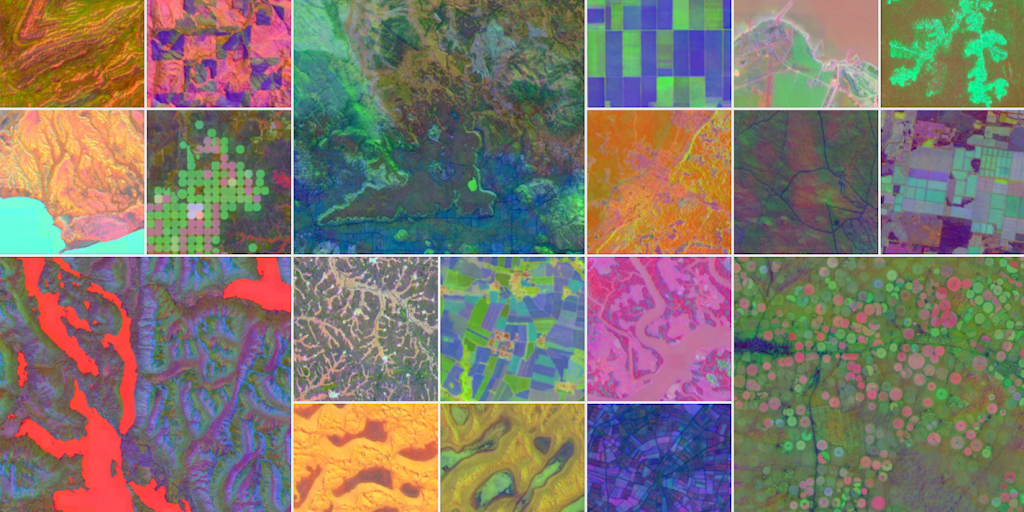
AlphaEarth Foundations: AI-Powered Virtual Satellite for Detailed Earth Mapping
AlphaEarth Foundations introduces a 'virtual satellite' that integrates petabytes of Earth observation data, including satellite images, rad
 Product Hunt·10mo ago
Landler: Natural Capital Management Platform Using Satellite Data and AI
Landler is a natural capital management platform developed by The Landbanking Group that combines satellite data, ecological science, and AI
Product Hunt·2mo ago
Skyfall-GS: Generating 3D Urban Scenes from Satellite Imagery Using Diffusion Models
Skyfall-GS is a novel system that synthesizes large-scale, explorable 3D urban scenes from satellite imagery using diffusion models. The app