
























First reported by bsky
Super Typhoon Bavi prompts emergency preparations in Guam and Northern Mariana Islands
A tropical "monster" could form over the Pacific with record-low central pressure: Bavi
By
Helena Mottram
2d agoen
Source
Theweather.comA tropical "monster" could form over the Pacific with record-low central pressure: Bavitheweather.comTropical Storm Bavi has been named after forming over the tropical Pacific. Numerical weather models indicate that it could strengthen into one of the most extreme tropical cyclones ever forecast for July, potentially becoming a historically powerful and exceptionally large super typhoon. Image of Tropical Storm Bavi at 05:00 UTC on 2 July 2026, showing its forecast track, cone of uncertainty and expected intensity. Tiempo.com. The waters of the tropical Pacific are exceptionally warm and, during an El Niño event, the western Pacific basin is capable of producing the most powerful tropical cyclones on Earth: extremely large and intense super typhoons. The possible Super Typhoon Bavi A new tropical storm, named Bavi, has formed over very warm open waters and is expected to strengthen significantly, with little to inhibit its development. It could grow to an enormous size while reaching exceptionally low central pressure values. According to the Joint Typhoon Warning Center (JTWC), Bavi is expected to pass through the Mariana Islands as a Category 4 or 5 super typhoon in approximately four days' time. Some forecast models suggest that Tropical Storm Bavi will intensify into a Category 5 super typhoon on the US scale by 5–6 July 2026, following a period of rapid intensification (RI) that could begin within the next 24 hours. ECMWF forecast showing pressure and rainfall (colour scale) for the period 2–10 July 2026, illustrating the possible development of Super Typhoon Bavi. Tropical Tidbits. The system is expected to reach sustained winds of at least 220 km/h and could even peak at around 260 km/h within the five-day forecast period as it approaches the Mariana Islands. If this occurs, it could become the strongest July typhoon to pass directly through the area since reliable records began. Super Typhoon Ragasa video: Harrowing Footage of Vehicles Swept Away by a Massive Landslide in Taiwan Earlier ECMWF model runs predicted that Bavi could deepen to 870 hPa during rapid intensification. The latest run now suggests a minimum central pressure of around 881 hPa. Other models are more conservative, forecasting minimum pressures closer to 900 hPa. It is worth remembering that the tropical cyclone with the lowest central pressure ever recorded was Super Typhoon Tip, which reached a minimum pressure of 870 hPa on 12 October 1979 over the western Pacific Ocean. It is unlikely that Bavi will fall to pressures as low as 870 hPa or rival Tip's record. Even so, it could still reach exceptionally low pressure values for the month of July. Bavi's central pressure could become historically low for the month of July (blue areas). Image: Tomer Burg. Meanwhile, the Atlantic remains remarkably quiet in terms of tropical cyclone development.
You might also wanna read
Super Typhoon Bavi approaches near Guam with extreme, life-threatening winds
CBSNews·2d ago


Guam and surrounding Pacific islands brace for impact of Super Typhoon Bavi
NPR·2d ago
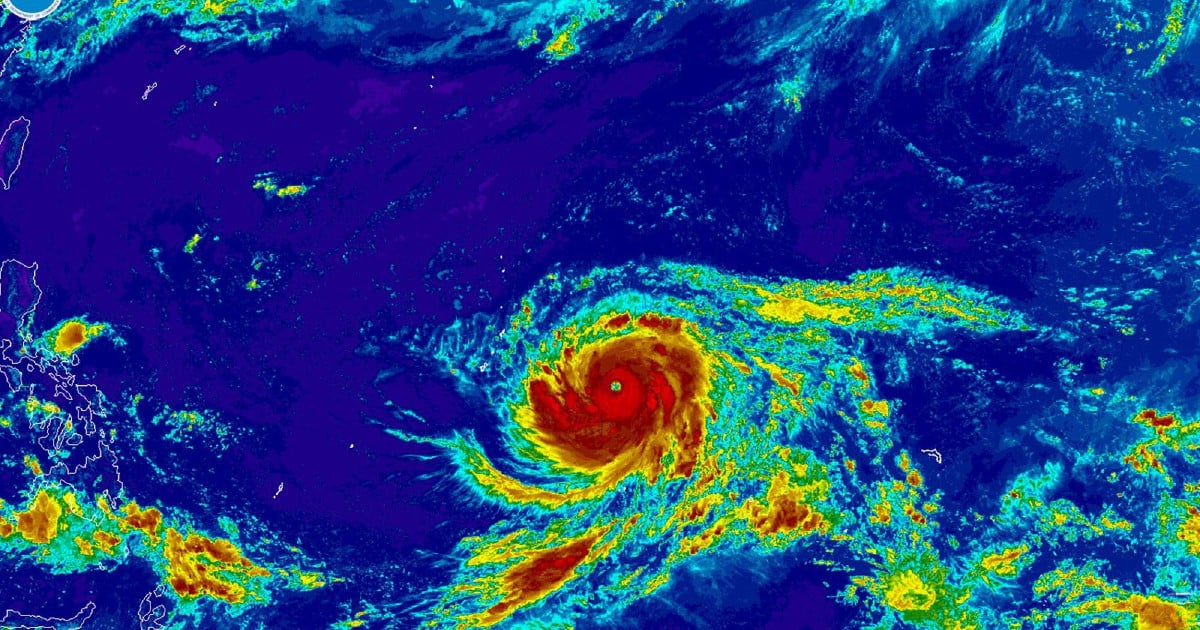
Super Typhoon Bavi prompts emergency preparations in Guam and Northern Mariana Islands
A brief news alert about Super Typhoon Bavi approaching Guam and the Northern Mariana Islands, described as the second super typhoon to hit
 nst.com.my·3d ago
'Grim outlook': 'Super typhoon' Bavi heads for US Pacific islands
today.rtl.lu·4d ago
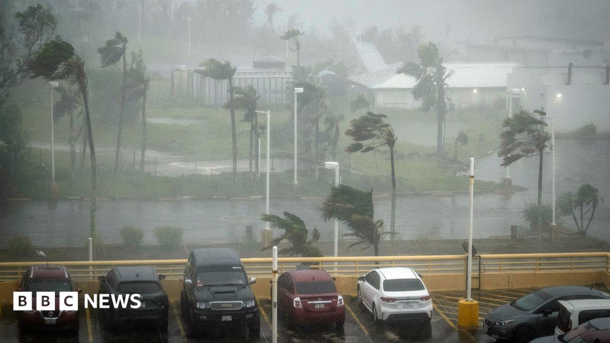
Super Typhoon Bavi hits Rota in Northern Mariana Islands with 290km/h winds
Super Typhoon Bavi, with winds of nearly 290km/h and gusts of 350km/h, is making landfall on the US Pacific island of Rota in the Northern M
 bbc.co.uk·1d ago
Super Typhoon Bavi makes landfall on US Pacific islands
Al Jazeera·2d ago
Comments
Sign in to join the conversation.
No comments yet. Be the first.