GeoLibre: A lightweight, cloud-native GIS platform for geospatial data visualization and analysis
By
jonbaer
Summary
GeoLibre is a lightweight, cloud-native GIS platform built with Tauri, React, TypeScript, MapLibre GL JS, DuckDB-WASM Spatial, and deck.gl. It enables visualizing, exploring, and analyzing geospatial data across desktop and web environments with responsive mobile support. The platform features fast local and cloud-native data processing, project files, styling, plugins, and modern geospatial workflows.
Source

Key quotes
· 3 pulledGeoLibre is built with Tauri, React, TypeScript, MapLibre GL JS, DuckDB-WASM Spatial, and deck.gl.
The same workspace runs across desktop and web environments, adapting responsively to mobile screens.
Fast local and cloud-native data work, project files, styling, plugins, and modern geospatial workflows.
You might also wanna read


Tauri: A Rust-based framework for building cross-platform desktop and mobile apps with web frontends
Tauri is an open-source framework for building desktop and mobile applications using web front-end technologies (HTML, JS, CSS) with a Rust-
 github.com·5h ago
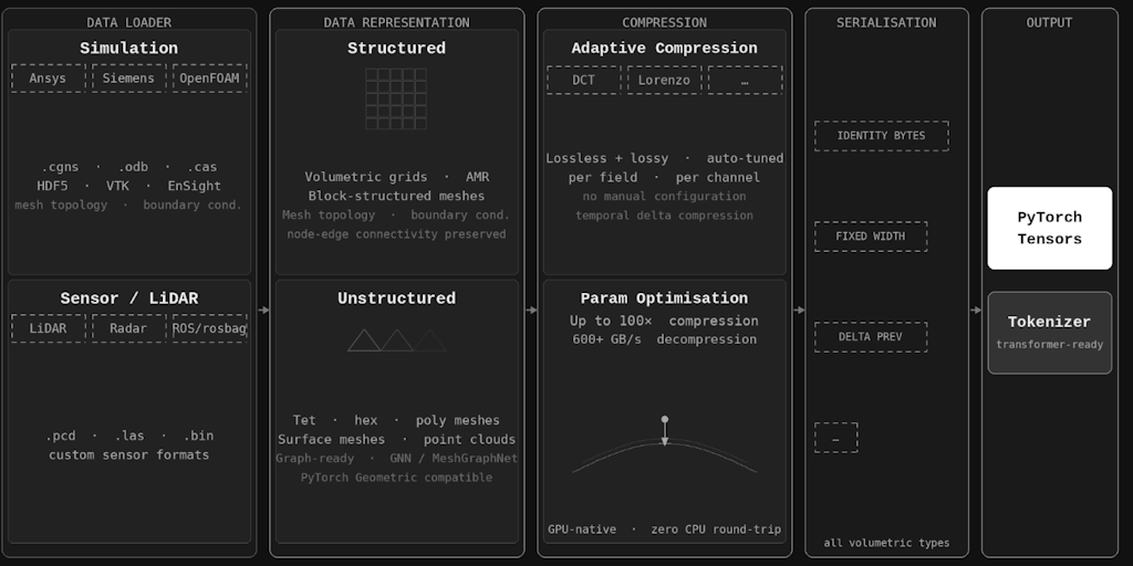
Zibra AI Launches GPU-Native Data Orchestration Platform for Spatial AI Training
Zibra AI introduces a GPU-native data orchestration platform designed to solve I/O bottlenecks in spatial and physical AI training. The plat
 Product Hunt·1mo ago
PangeAI: AI-Powered Geospatial Analysis Platform for Instant Spatial Decision-Making
PangeAI is an AI-powered platform that provides instant spatial analysis and decision-making capabilities by acting as an agentic layer over
Product Hunt·2mo ago
GMI Cloud Console: Platform for AI Teams to Deploy and Scale GPU Clusters
GMI Cloud Console is a platform that enables AI teams to quickly deploy and scale GPU clusters, ranging from single inference nodes to multi
Product Hunt·7mo ago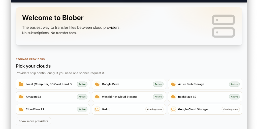
Blober.io: A Local-First Workflow Engine for Managing Files Across Cloud Storage Providers
Blober.io is a local-first workflow engine designed to help developers and teams manage large-scale data transfers between different cloud s
Product Hunt·5mo ago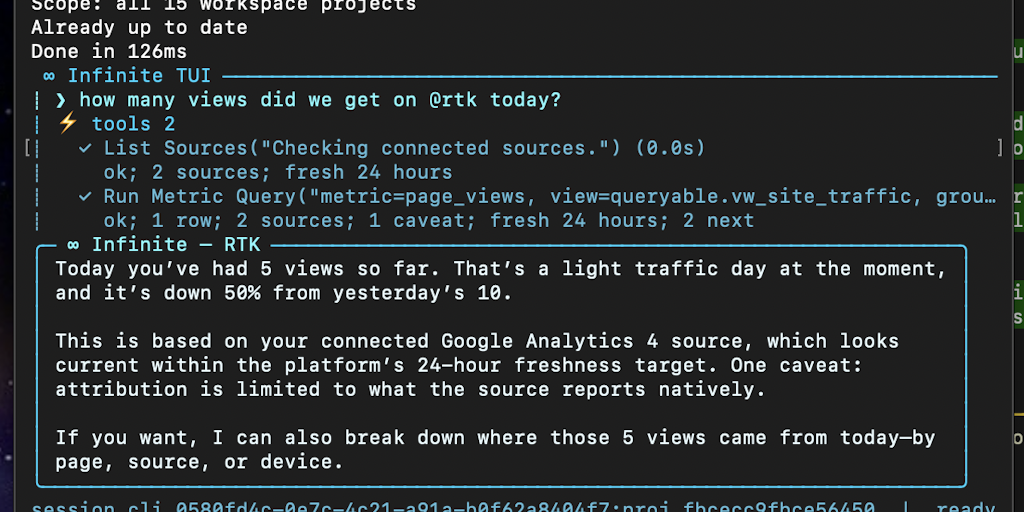
Infinite: Open-source local analytics unification tool for GA4, PostHog, Meta, and Stripe data
Infinite is an open-source tool that unifies analytics data from platforms like GA4, PostHog, Meta, and Stripe into a local database on the
Product Hunt·3d ago