Why is Google Maps back to showing old satellite images of Altadena?
By
tgrowazay
Article URL: https://www.reddit.com/r/pasadena/s/94BHlkE84r
Comments URL: https://news.ycombinator.com/item?id=48176762
Points: 5
# Comments: 0
You might also wanna read


NYU Researcher Explains Why AI Models Still Struggle to Play Video Games
Julian Togelius, director of NYU's Game Innovation Lab and co-founder of Modl.ai, discusses a recent paper exploring why LLMs and AI models
 spectrum.ieee.org·42m ago
Kefir C compiler development moves to private mode indefinitely
The developer of the Kefir C compiler announces the cessation of public development, transitioning the project to private mode indefinitely.
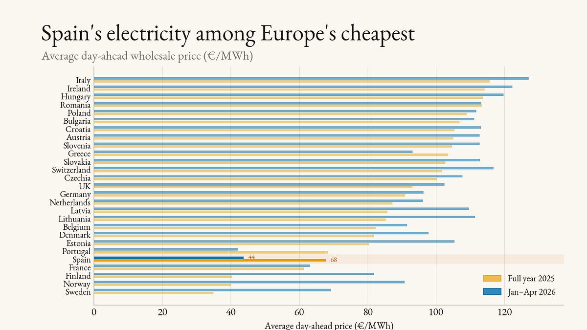
How wind and solar made Spain one of Europe's cheapest electricity markets
Spain's wholesale electricity prices have dropped dramatically to become among Europe's cheapest, averaging €44/MWh in early 2026 compared t
 janrosenow.substack.com·1h ago
Meta legal action forces Facebook whistleblower to sit in silence at Hay festival

Exploring the Butlerian Jihad: Why Dune's world has no AI and what it means for our future
An opinion piece exploring the absence of AI in Frank Herbert's Dune universe through the concept of the Butlerian Jihad, connecting it to c

A critique of misusing "backpressure" in AI code-generation system design
This article critiques Lucas Costa's piece on building systems for code-generating AI robots, arguing that Costa misuses the term "backpress
 entropicthoughts.com·2h ago