Sightline: An OSINT Search Engine for Mapping Real-World Infrastructure from OpenStreetMap Data
By
ni5arga
Slow-proofed and worth the wait. Worth its weight in flour.
Summary
Sightline is an open-source intelligence (OSINT) search engine that enables users to discover, monitor, and analyze real-world infrastructure using OpenStreetMap data. The platform allows searching for various types of physical assets including telecommunications towers, power plants, airports, ports, military installations, government facilities, and other critical infrastructure. It serves as a geospatial intelligence tool for mapping and analyzing physical-world assets from publicly available map data.
Key quotes
· 4 pulledGeospatial infrastructure intelligence platform for discovering and analyzing physical-world assets using OpenStreetMap data.
Sightline enables searching, monitoring, and analyzing real-world infrastructure including: Telecommunications towers and data centers, Power plants, substations, and energy storage, Airports, helipads, and cable transport (gondolas, funiculars)
Ports, harbours, piers, and maritime facilities, Warehouses and industrial facilities, Pipelines, refineries, and energy infrastructure
Military installations, Hospitals, prisons, embassies, and government facilities
You might also wanna read


How Anthropic contains Claude's expanding access across its products
Anthropic describes how it has evolved its approach to granting Claude, its AI assistant, increasingly broad access to internal systems over
 anthropic.com·3h ago
Testing Cursor's Jira integration: How ticket quality affects AI agent performance
Cursor launched a Jira integration that lets developers assign tickets directly to an AI agent, eliminating context switching. The author te
 bit.ly·3h ago
Netflix engineer's open-source tool cuts AI token usage by up to 90%
Netflix senior engineer Tejas Chopra created software called "Project Headroom" that prunes redundant tokens from AI agent instructions befo
 theregister.com·4h ago
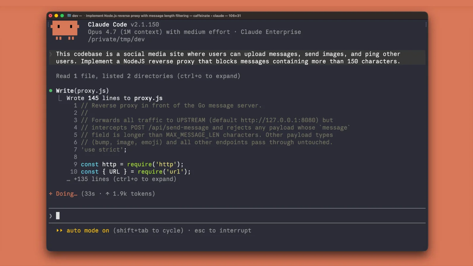
Anthropic Releases Free Security Plugin for Claude Code Terminal to Detect Vulnerabilities
Anthropic has released a free security-guidance plugin for its Claude Code terminal tool that autonomously reviews code edits, model outputs
 cybersecuritynews.com·4h ago
Researcher's "ADHD" tool for Claude Code claims 2x improvement; experts call for more evidence
Solo researcher Udit Akhouri released a third-party Agent SDK tool called "ADHD" for Claude Code on Reddit, claiming it helps coding agents
bit.ly·4h ago
How to Self-Host a Bluesky Personal Data Server on Ubuntu VPS
This article provides a step-by-step technical guide for self-hosting a Bluesky Personal Data Server (PDS) on an Ubuntu VPS. It explains wha
 blog.radwebhosting.com·5h ago