Urban Flood Observations (UFO): A hand-labeled satellite imagery dataset for urban inundation mapping
By
[Submitted on 24 Apr 2026 (v1), last revised 6 Jun 2026 (this version, v2)]
Properly proved. Has structure, has flavour, has a point.
Summary
This paper presents Urban Flood Observations (UFO), a global hand-labeled dataset of post-flood inundation in urban environments. The dataset contains 215 image chips (1024x1024 pixels) from 14 flood events between 2017-2021, derived from 3m PlanetScope satellite imagery. Each chip is annotated with 'inundated' and 'non-inundated' classes. A segmentation model trained using leave-one-event-out cross-validation achieved a mean IoU of 77.3. The dataset was also used to evaluate two existing surface water products (NASA IMPACT model and Google's Dynamic World), which yielded lower IoUs of 44.1 and 48.1 respectively. The dataset is publicly available to support urban inundation mapping research.
Key quotes
· 5 pulledUrban flooding affects lives and infrastructure worldwide.
We present Urban Flood Observations (UFO), a global, hand-labeled dataset of post-flood inundation in diverse urban settings.
UFO comprises 215 image chips (1024 by 1024 pixels) from 14 flood events between 2017 and 2021, derived from 3 m PlanetScope imagery.
We trained a segmentation model using leave-one-event-out cross-validation, achieving a mean Intersection over Union (IoU) of 77.3.
UFO is publicly available to support the development and validation of urban inundation mapping methods.
You might also wanna read


Machine Learning Validates Unrecognized Transient Astronomical Phenomena in Historical Observatory Images
This research paper uses machine learning to validate the existence of previously unrecognized transient astronomical phenomena in historica

Field Testing Satellite-Based Bramble Detection for Hedgehog Habitat Mapping
Researchers conducted field testing of a machine learning model designed to identify bramble habitats from satellite data, specifically for
Google Earth AI Expands Disaster Response and Environmental Monitoring Capabilities
Google Earth AI is being expanded to provide critical disaster response capabilities, including flood forecasting covering over 2 billion pe
 blog.google·7mo ago
Skyfall-GS: Generating 3D Urban Scenes from Satellite Imagery Using Diffusion Models
Skyfall-GS is a novel system that synthesizes large-scale, explorable 3D urban scenes from satellite imagery using diffusion models. The app
EyeOnBlue: Satellite Imagery and AI Platform for Environmental Monitoring and Disaster Prediction
EyeOnBlue is a satellite imagery and AI platform that uses remote sensing technology for environmental monitoring, disaster prediction, and
 Product Hunt·1mo ago
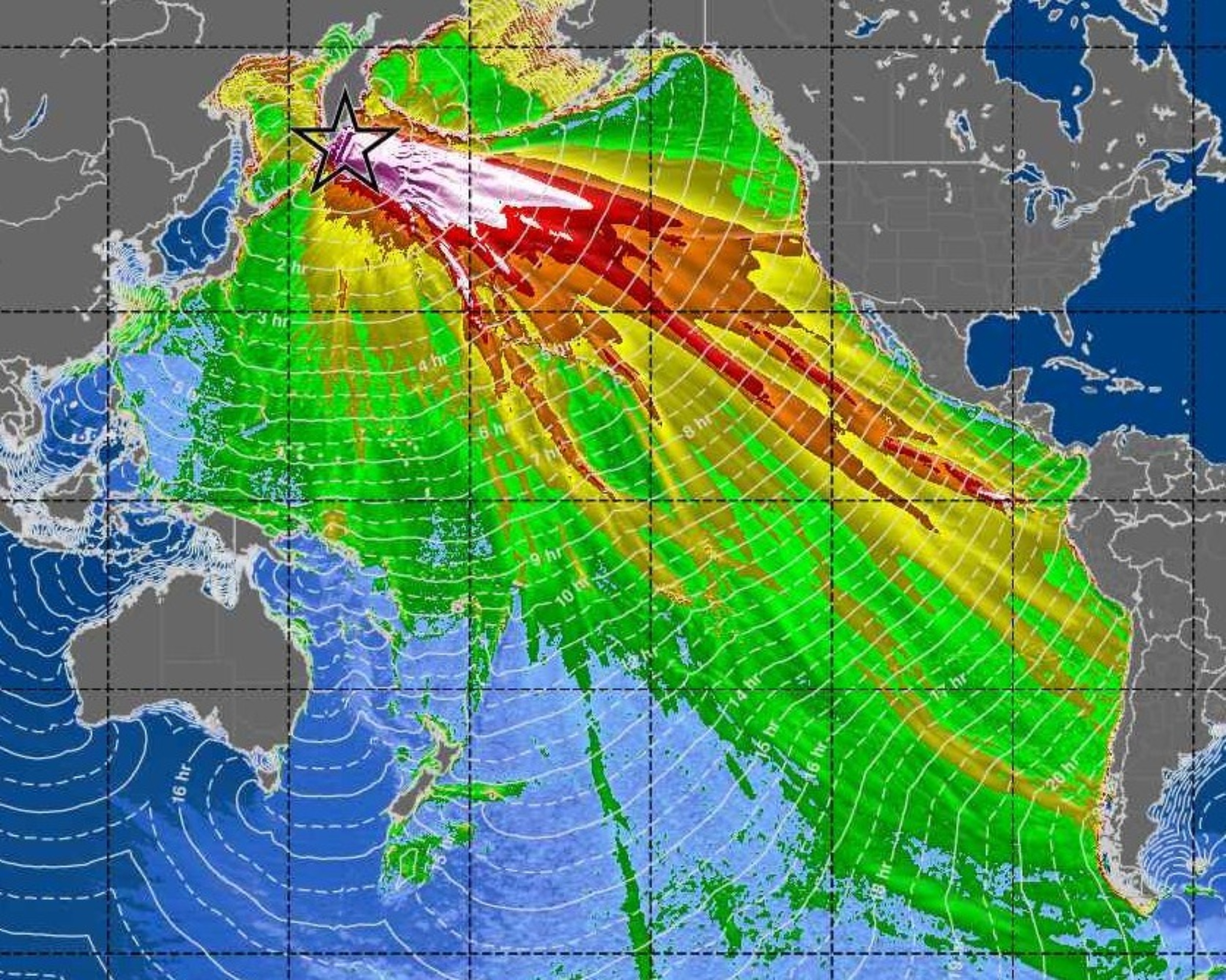
SWOT Satellite Captures High-Resolution Images of Pacific Tsunami, Revealing Complex Wave Patterns
NASA and French space agency's SWOT satellite captured unprecedented high-resolution images of a Pacific-wide tsunami generated by a magnitu
 earth.com·6mo ago